Political Map of Turkmenistan (Republic of Turkmenistan; Türkmenistan Respublikasy, also known as Turkmenia) | ||
Map is showing Turkmenistan, a republic in central Asia that became independent in 1991 following the collapse of the Soviet Union. The country lies east of the Caspian Sea, south of Kazakhstan and Uzbekistan, and north of Iran and Afghanistan. The Turkmen-Khorasan Mountain Range (Kopet Dag) in south west separates the country from Iran. Highest mountain is Aýrybaba with 3, 138 m (10,295 ft), situated in the Köýtendag Range along the border with Uzbekistan. Turkmenistan's landscape is dominated by the Turan Depression, a low-lying desert basin, and the Karakum Desert which covers 75% of the country’s area of 488,100 km². Compared the country is somewhat smaller than Spain, or slightly larger than the US state of California. Turkmenistan is sparsely populated, with a population of just 5.4 million people. Capital and largest city is Ashgabat (Aşgabat). Ethnic groups are Turkmen (85%) Uzbek (5%) and Russian (4%). Spoken languages are Turkmen (official) and Russian (as an inter-ethnic language). Main religions are Muslim 84%, Eastern Orthodox 17%. Depicted on the map are cities, and towns (see below), main roads, railroad and primary airports. |  Bookmark/share this page |  One World - Nations Online all countries of the world |
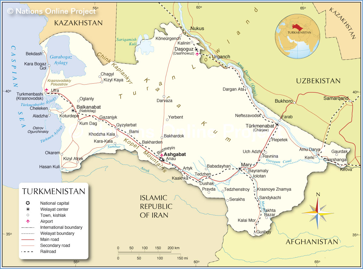 Political Map of Turkmenistan |
Comments
Post a Comment