Map of Iraq, Middle East

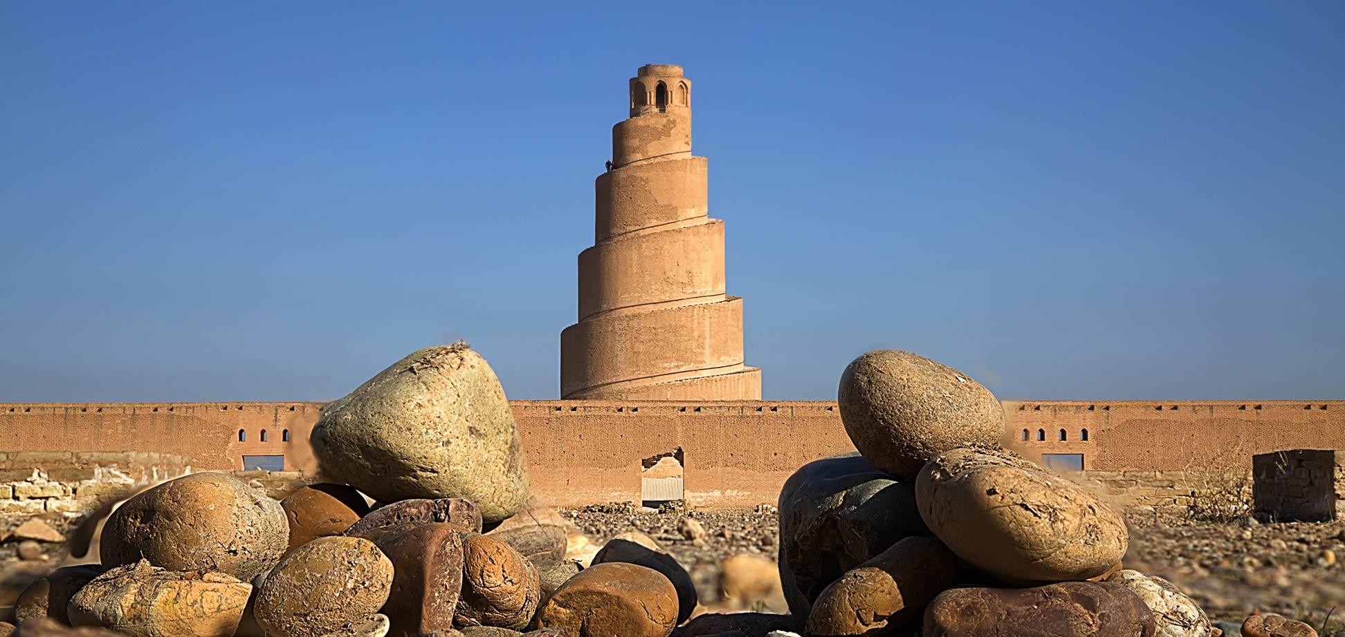
The ninth-century Great Mosque of Samarra is located in Samarra Archaeological City, a UNESCO World Heritage Site.
Image: Taisir Mahdi
About Iraq

Iraq borders Turkey, Iran, Syria, Jordan, Kuwait, and Saudi Arabia.
The territory of today Iraq was very sought-after; it was the center of several consecutive empires the Akkadian, Sumerian, Assyrian, and the Babylonian empire. The Romans went there, the Persians, the Mongols, and the Greeks. The country became successively part of the Arab Islamic Rashidun, Umayyad, and Abbasid caliphates.
In the 16th-century the land was integrated into the Ottoman Empire. From the sixteenth to the twentieth centuries, the course of Iraqi history was affected by continuing conflicts between the Safavid Empire in Iran and the Ottoman Turks. [1]
After the collapse of the Ottoman Empire, Iraq was occupied by the United Kingdom. In 1920 it was declared a League of Nations mandate under UK administration, the country gained independence from the UK in 1932.
With an area of 438,317 km², Iraq is somewhat smaller than France, or slightly larger than the US state of California.
Iraq has a population of about 40 million people (in 2019), major ethnic groups are Arabs (75-80%), Kurds (15%), and Turkmens. Capital and largest city is Baghdad. The official languages of Iraq are Arabic and Kurdish; other spoken languages are Turkmen (a Turkish dialect), Syriac (Neo-Aramaic), and Armenian. The official religion is Islam.
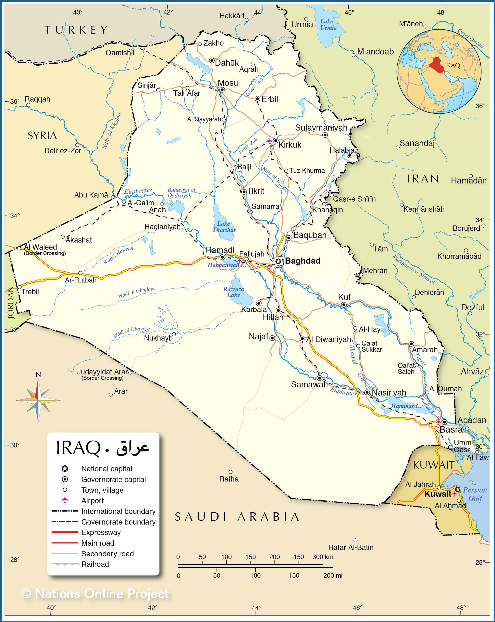
Map of Iraq

Political Map of Iraq
The map shows Iraq and surrounding countries with international borders, the national capital Baghdad, governorate capitals, major cities, main roads, railroads, and major airports.

Political Map of Iraq
The map shows Iraq and surrounding countries with international borders, the national capital Baghdad, governorate capitals, major cities, main roads, railroads, and major airports.
- Get link
- X
- Other Apps
- Get link
- X
- Other Apps
Comments
Post a Comment