Map of Lebanon, Middle East

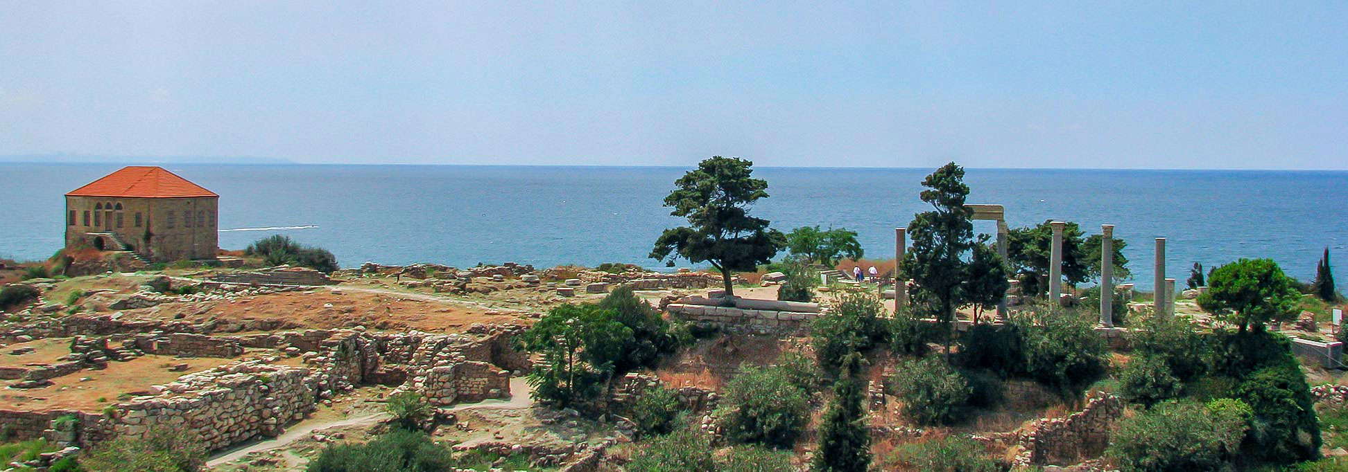
Ruins of many successive civilizations in the ancient complex of Byblos at the Mediterranean coast.
Image: Evilscaught
About Lebanon

The smallest nation on the Asian mainland covers an area of 10,400 km², compared it is about one-third the size of Belgium or about one-third the size of the US state of Maryland.
Lebanon has a population of about 6.1 million people (in 2019) including approximately 1.5 million refugees from Syria and Palestine. [1] The majority of the Lebanese people live on or near the Mediterranean coast.
The country's national capital and largest city is Beirut. Spoken language is Lebanese Arabic. Lebanon has the most religiously diverse society in the Middle East, main religions are Islam (58%), followed by Christianity (36%), and Lebanese Druze faith (5%).
Lebanon's main geographical features
Lebanon has a narrow coastal strip along the Mediterranean Sea. The coast is home to most of the larger cities and towns of the country. Agriculture in the region produces fruits and vegetables.
Mount Lebanon is a mountain range that dominates the entire country; it extends along the Mediterranean coast for about 160 km (100 mi). Located within the range is Qurnat As Sawda, the Levant's highest mountain, at an elevation of 3,093 m (10,148 ft).
The Anti-Lebanon mountains, the "Eastern Mountains of Lebanon" is a mountain range in the east of the country. Along its crest runs the Lebanon-Syria border.
The Beqaa Valley (Al-Biqā) is a high plateau at an average elevation of 1000 m, situated between the Mount Lebanon range to the west and Anti-Lebanon mountains to the east. The northeasternmost extension of the Great Rift Valley is a major farming region; it contains nearly half of Lebanon’s arable land.
Primary Level Administrative Divisions of Lebanon
Lebanon is divided into eight governorates (muhafazah, Arabic: محافظات ). These governorates are from the north to the south (capitals in brackets):
Akkar (Halba); North Governorate (ash Shamal; capital is Tripoli); Baalbek-Hermel (Baalbek); Mount Lebanon (Baabda)
Beirut Governorate (Beirut); Beqaa Governorate (Zahle), Nabatieh Governorate (Nabatiye), and the South Governorate (Sidon).
Map of Lebanon

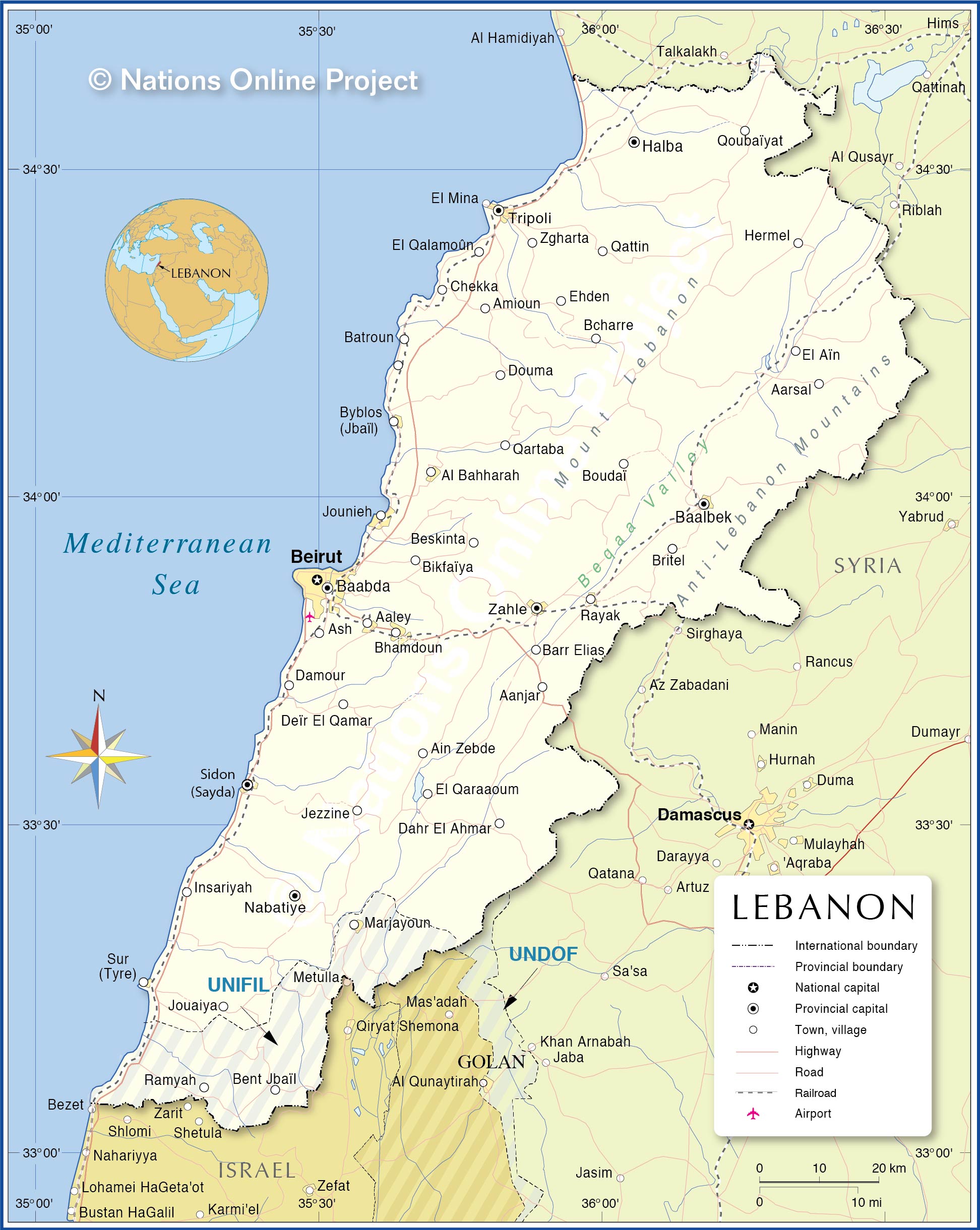
Political Map of Lebanon
The map shows Lebanon and surrounding countries with international borders, the national capital Beirut, governorate capitals, major cities, main roads, railroads, and major airports.

Political Map of Lebanon
The map shows Lebanon and surrounding countries with international borders, the national capital Beirut, governorate capitals, major cities, main roads, railroads, and major airports.
- Get link
- X
- Other Apps
- Get link
- X
- Other Apps
Comments
Post a Comment