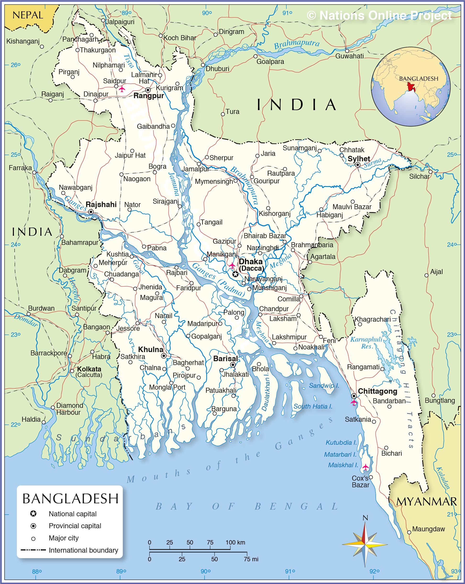
Map of Bangladesh

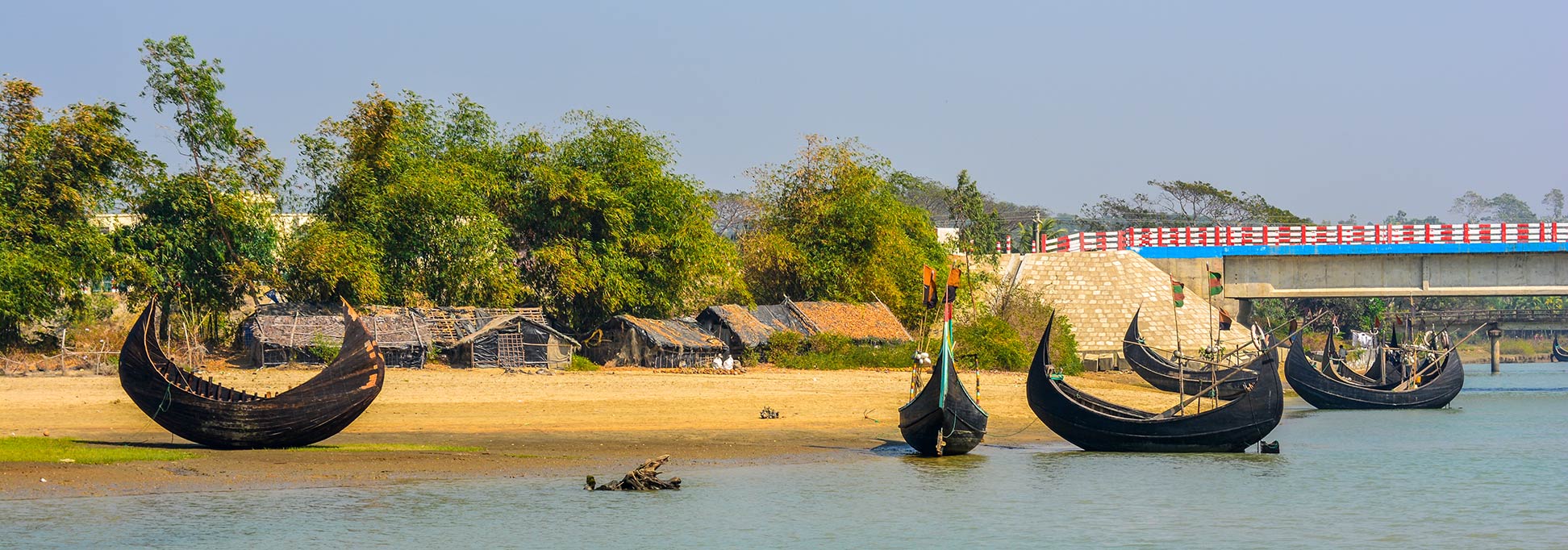
Fishing boats at Inani Beach in Ukhia Upazila of Cox's Bazar District in southeastern Bangladesh.
Image: Syed Sajidul Islam
About Bangladesh

Together with the Indian state of West Bengal, it makes up the historical and geographical region of Bengal.

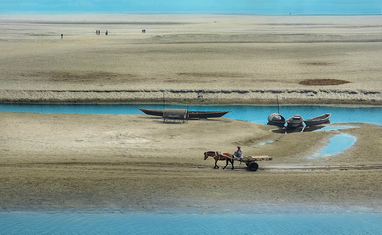
Brahmaputra River seen from Fulchhari Ghat in Gaibandha district, Rangpur Division, in Northern Bangladesh.
Photo: Abdul Momin
A population of more than 168 million people (in 2019), makes Bangladesh one of the most densely populated countries in the world. The majority of Bangladesh's population are Muslim (about 88%). Spoken language is Bangla (or Bengali by 98%).
Large parts of Bangladesh are in the low-lying Ganges Delta. The delta is formed by the confluence of the Ganges (local name Padma), Brahmaputra (Jamuna), and Meghna rivers and their tributaries.
The highest point in Bangladesh is in Mowdok range at 1,052 m (3,451 ft) in the Chittagong Hill Tracts.
The map shows Bangladesh and surrounding countries with international borders, the national capital Dhaka (Dacca), province capitals, major cities, main roads, railroads, and major airports.
The principal airport of Bangladesh is Zia International Airport (IATA code: DAC) at Dhaka, there are two more international airports: Shah Amanat International Airport (formerly M.A. Hannan Int'l) (IATA: CGP) at Chittagong and Osmani International Airport (IATA: ZYL) at Sylhet. Regional airports at Barisal (IATA: BZL), Cox's Bazar (IATA: CXB), and at Saidpur (IATA: SPD).
- Get link
- X
- Other Apps
- Get link
- X
- Other Apps

Comments
Post a Comment