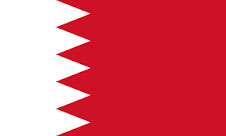
Map of Bahrain, Middle East

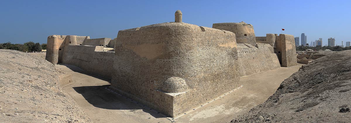
View of Bahrain Fort; Qal’at al-Bahrain – Ancient Harbour and Capital of Dilmun
Image: Martin Falbisoner
About Bahrain

Bahrain shares maritime borders with Iran, Qatar, and Saudi Arabia.
Area
With an area of 741 km², the island nation is slightly larger than Singapore (699 km²), or 3.5 times the size of Washington, DC. Like other wealthy island nations, Bahrain's area is growing due to land reclamation.
Bahrain's geography can be described as a flat, arid desert archipelago in the Persian Gulf; less than 3% of the country is arable land. Jabal ad Dukhan (Mountain of Smoke), the hill in the center of the Southern Governorate is the country's highest point at 134 m (440 ft).
Population
The kingdom has a population of 1,424,000; thereof 665,000 people are Bahraini, 759,000 were non-nationals (in 2016). [1]
Bahrain's islands
Bahrain Island (al-Awal Island), the country's main island is about 50 km (30 mi) long and 16 km (10 mi) wide. Muharraq is the name of a densely populated island and a city, situated northeast of Manama; to the north of Muharraq's urban area lies Bahrain International Airport. Hawar (Jazīrat Ḩawār) is an archipelago of 16 small desert islands situated off the west coast of Qatar; the main island is Hawar. The islands support one of the world's largest concentrations of the Socotra Cormorant. [2]Umm an Nasan is an island in the Gulf of Bahrain, linked with the main island by the King Fahd Causeway; it is privately owned and off limits to ordinary people.
Bahrain International Airport (IATA Code: BIA) is located on the island of Muharraq; it is Bahrain's only international airport. It is the primary hub for Gulf Air, the flag carrier of Bahrain.
Bahrain Administrative Divisions
Bahrain is divided into five regions called governorates. These governorates are:
the Capital Governorate,
the Central Governorate,
the Muharraq Governorate,
the Northern Governorate,
and the Southern Governorate, which also includes the Hawar islands in the south-east of the archipelago.
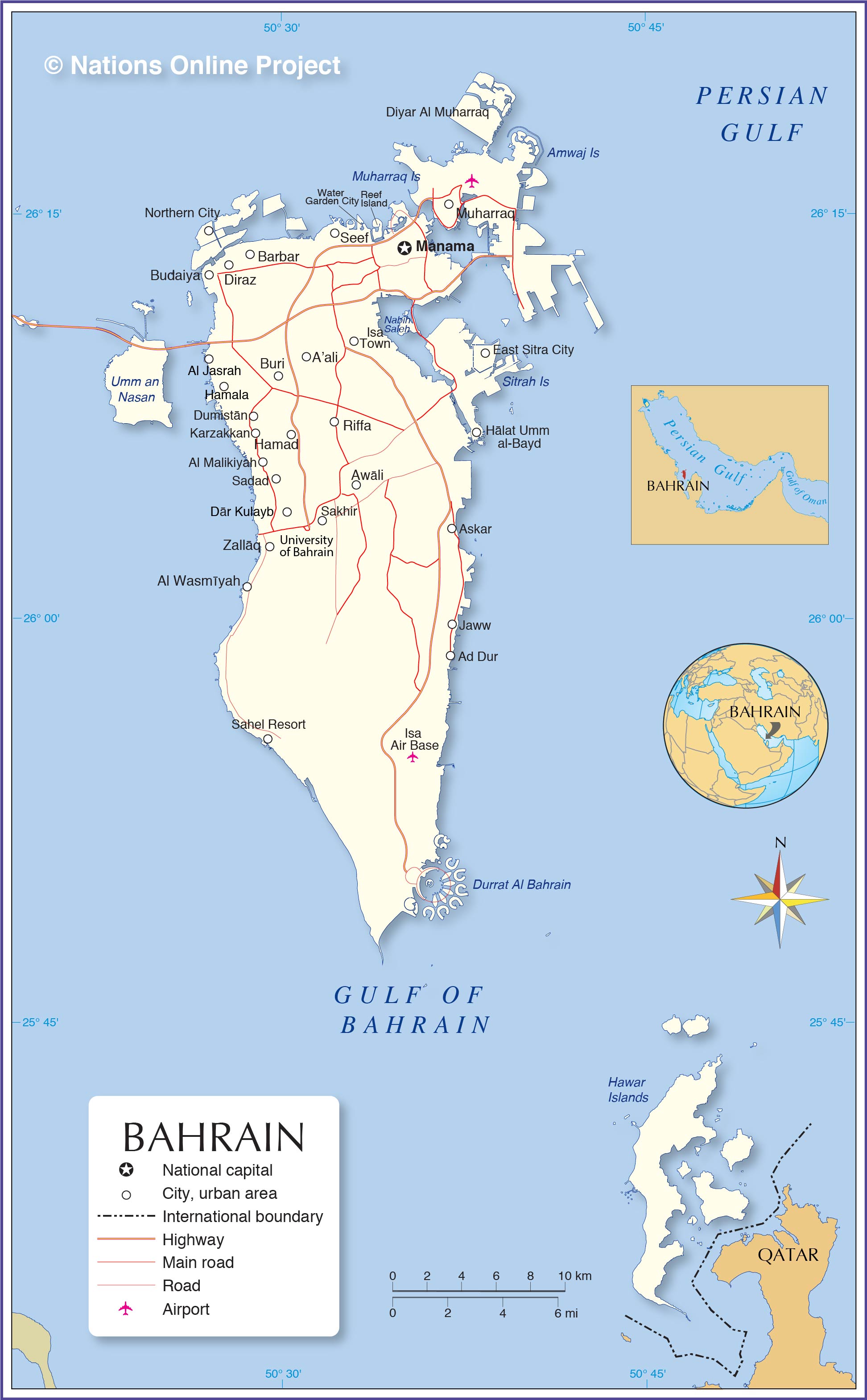
Map of Bahrain

Political Map of Bahrain
The map shows Bahrain in the Gulf of Bahrain, with governorate boundaries, the national capital, major cities, and main roads.
 You are free to use above map for educational purposes (fair use), please refer to the Nations Online Project.

Political Map of Bahrain
The map shows Bahrain in the Gulf of Bahrain, with governorate boundaries, the national capital, major cities, and main roads.
More about Bahrain

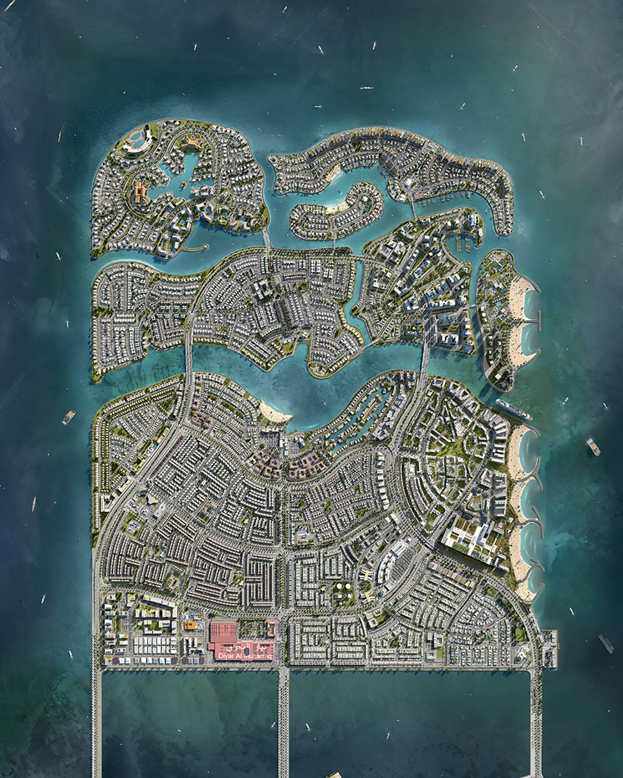
The Master Plan of Diyar Al Muharraq Real Estate Development Project in the Kingdom of Bahrain. Diyar Al Muharraq is under construction on reclaimed land north of Bahrain International Airport.
Photo: Diyar Al Muharraq
The map shows the location of following Bahrainian cities and towns:
Manamah (al-Manāma) is the capital and the largest city of Bahrain.
Riffa, the second largest city in Bahrain, is located in the center of the northern portion of the main island; it is famous for the Riffa Fort, a fortress overlooking the Hunanaiya Valley. The city is made up of West Riffa (Ar Rifa' al Gharbi) and East Riffa (Ar Rifa 'ash Sharqi).
Muharraq (Al Muharraq), Bahrain's third largest city is situated northeast of the capital; it is the location of Bahrain International Airport, the country's only international airport.
A'ali, the city is famous for its ancient burial mounds and its traditional handcrafted pottery.
Amwaj Islands
A group of man-made islands, a land reclamation project north-east of the airport offering waterfront properties. In the center sits the Lagoon Park, an artificial lagoon with coffee shops and restaurants.
Diyar Al Muharraq, the future city with commercial and residential facilities, will cover seven artificial islands of reclaimed land. First inhabitants moved to the islands in 2015.
East Sitra City
Another ongoing mega land reclamation project to the east of Sitra Island. Planned are residential areas, light and heavy industry plants, and military facilities.
Durrat Al Bahrain
Durrat Al Bahrain is the kingdom's answer to Dubai's Palm Islands. A 20 km² reclaimed series of islets at the south-eastern tip of Bahrain's main island. The mini-archipelago offers luxury residential areas, townhouse villas, and tourist resorts. Durrat Al Bahrain will be home to over 2,000 beachfront villas, 3,600 executive apartments and offices, a luxury hotel, a spa resort, parks and entertainment grounds, mosques and international schools, premier retail malls and restaurants, a 400-berth marina and an 18-hole championship golf course. [3]
Sahel Resort
Sahel Resort is a new five-star property under construction in the south-west coastal region of Bahrain. The secluded 'retreat' style venue will offer room and villa-based accommodation and a range of entertainment, leisure, and sports facilities, including restaurants, a cinema, a kids club, and meeting and conference services.
- Get link
- X
- Other Apps
- Get link
- X
- Other Apps
Comments
Post a Comment